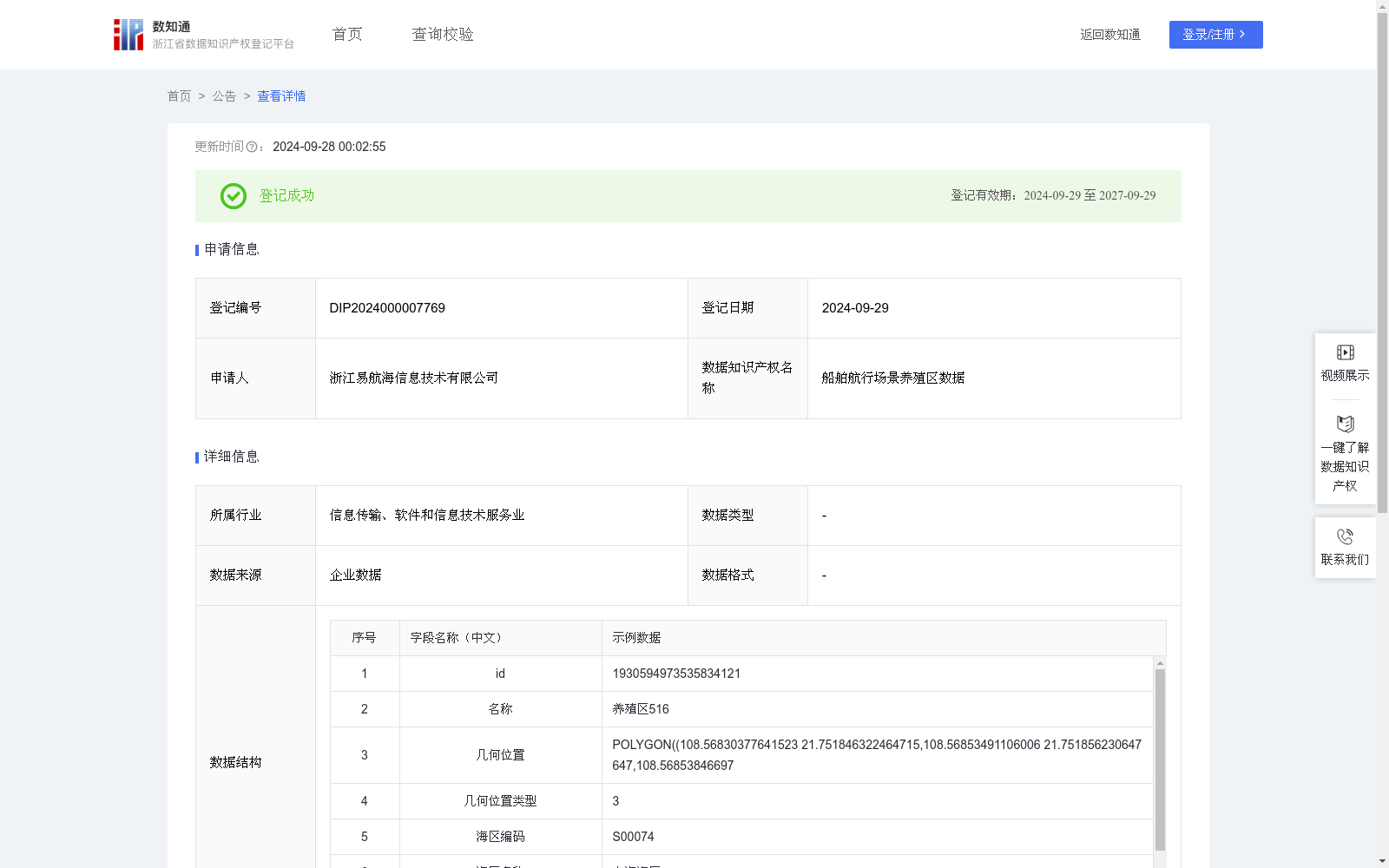
船舶航行场景养殖区数据
收藏资源简介:
为保护和管理海上养殖区内的水生生物及确保养殖设施安全和船舶的航行安全,限制部分船舶进入养殖区。通过电子海图可视化养殖区范围,促使船员规划航线以避开养殖区。由于养殖区边缘随季节变化,养殖区可视化数据需要随时间更新,确保船员在接近养殖区时注意航行安全。养殖区初始坐标数据来源于海事局、纸质海图等,通过对原始地理位置数据进行可视化处理,数据存储为WKT格式。WKT格式由两部分组成,一部分描述空间几何对象的类型和坐标系信息(例:LINESTRING (x1 y1, x2 y2, ..., xn yn)),另一部分则是空间几何对象的坐标点的序列,系统通过坐标类型的枚举匹配识别出当前WKT的对象类型(几何位置类型点1、线2、面3、多点4、多线为5、多面为6,养殖区类型为面3),然后根据对象类型对其包含的空间信息进行二次处理,根据点、线、面、多线、多面等情况进行处理后生成经纬度列表数据。按照数据类型,在我司后台上进行养殖区几何图绘制,并记录相关属性至数据后台,电子海图上显示养殖区范围。
To protect and manage aquatic organisms within marine farming areas, ensure the safety of farming facilities and ship navigation, access of certain vessels to these farming areas is restricted. The scope of farming areas is visualized via electronic navigational charts, enabling seafarers to plan routes to avoid entering the farming zones. Since the boundaries of farming areas vary with seasons, the visualized farming area data must be updated in a timely manner to ensure seafarers remain aware of navigation safety when approaching such areas. The initial coordinate data of farming areas is sourced from maritime administrations, paper nautical charts, and other relevant channels. After visual processing of the original geographic location data, the dataset is stored in Well-Known Text (WKT) format. The WKT format comprises two components: one describes the type of spatial geometric object and coordinate system information (e.g., LINESTRING (x1 y1, x2 y2, ..., xn yn)), while the other consists of the sequence of coordinate points of the spatial geometric object. The system identifies the object type of the current WKT by matching against enumerated coordinate types (enumeration values: point 1, line 2, polygon 3, multi-point 4, multi-line 5, multi-polygon 6; the farming area type is polygon 3). It then conducts secondary processing on the contained spatial information, and generates longitude-latitude list data after handling cases such as point, line, polygon, multi-line and multi-polygon geometries. According to the data type, the geometric diagram of the farming area is drawn on our company’s backend system, with relevant attributes recorded in the data backend. Finally, the scope of the farming areas is displayed on the electronic navigational charts.